Travel Guide of Dughla in Nepal by Influencers and Travelers
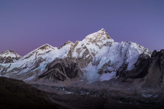
Dughla is a small hamlet in Solukhumbu District in the Himalayas of Nepal, to the south of Khumbu Glacier. The settlement, consisting of several huts, is located at an elevation of 4,620 metres, making it one of the highest settlements in the world, but likely not permanently inhabited all year around as it is essentially a collection of huts catering to hikers.
Pictures and Stories of Dughla from Influencers
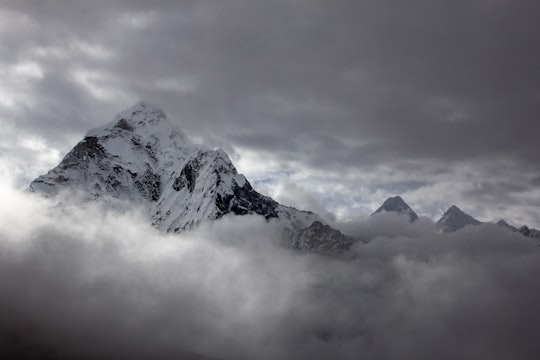
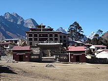
Picture from Theodor Lundqvist who have traveled to Dughla
Plan your trip in Dughla with AI 🤖 🗺
Roadtrips.ai is a AI powered trip planner that you can use to generate a customized trip itinerary for any destination in Nepal in just one clickJust write your activities preferences, budget and number of days travelling and our artificial intelligence will do the rest for you
👉 Use the AI Trip Planner
The Best Things to Do and Visit around Dughla
Disover the best Instagram Spots around Dughla here
1 - Cholatse
Cholatse is a mountain in the Khumbu region of the Nepalese Himalaya. Cholatse is connected to Taboche by a long ridge. The Chola glacier descends off the east face.
View on Google Maps Book this experience
2 - Amadablam Expedition
Taboche is a mountain in the Khumbu region of the Nepalese Himalaya. Taboche is connected to Cholatse by a long ridge. Taboche lies directly across the Imja River from Ama Dablam and above the villages of Pheriche and Dingboche.
View on Google Maps Book this experience
3 - Trekking | Everest Base Camp
Everest Base Camp Trek is a lifetime dream vacation for people from the world
Learn more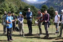
4 - Lobuche
Lobuche is a Nepalese mountain which lies close to the Khumbu Glacier and the settlement of Lobuche. There are two main peaks, Lobuche East and Lobuche West.
Learn more Book this experience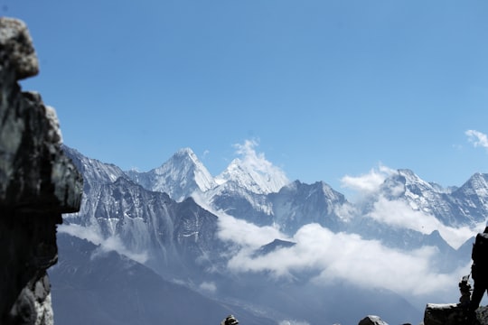

5 - Dingboche
Dingboche 27°53′N 86°49′E is a Sherpa village in the Khumbu region of north eastern Nepal in the Chukhung Valley. Its population was estimated at approximately 200 in 2011. It is situated at an altitude of 4,410 metres.
Learn more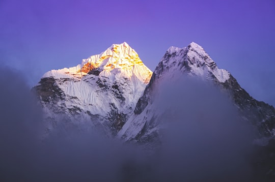
6 - Sagarmatha National Park
Sagarmāthā National Park is a national park in the Himalayas of eastern Nepal that is dominated by Mount Everest. It encompasses an area of 1,148 km² in the Solukhumbu District and ranges in elevation from 2,845 to 8,848 m at the summit of Mount Everest.
Learn more Book this experience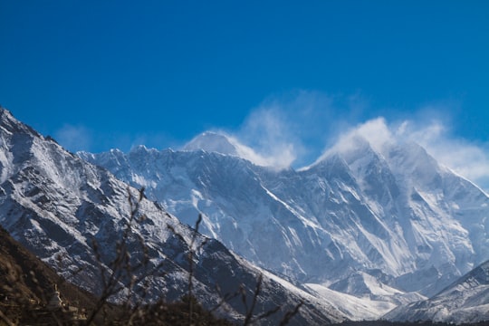

7 - Gorak Shep
7 km away
Gorak shep or Gorakshep is a small settlement that sits on the edge of a frozen lakebed covered with sand in Nepal with the same name. It is found at an elevation of 5,164 metres elevation, near Mount Everest. The village is not inhabited year-round.
Learn more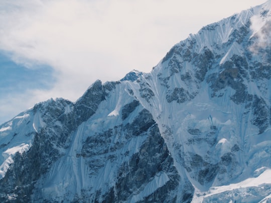
8 - Everest
7 km away
Learn more
9 - Kala Patthar Summit
9 km away
Kala Patthar, meaning 'black rock' in Nepali, Hindi and Urdu, is a notable landmark located on the south ridge of Pumori in the Nepalese Himalayas above Gorakshep.
Learn more Book this experience

10 - Ama Dablam
10 km away
Ama Dablam is a mountain in the eastern Himalayan range of Province No. 1, Nepal. The main peak is 6,812 metres, the lower western peak is 6,170 metres.
Learn more Book this experience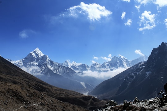

11 - Pumori
11 km away
Pumori is a mountain on the Nepal-China border in the Mahalangur section of the Himalayas. Pumori lies just eight kilometres west of Mount Everest. Pumori, meaning "the Mountain Daughter" in Sherpa language, was named by George Mallory. "Pumo" means young girl or daughter and "Ri" means mountain in Sherpa language. Climbers sometimes refer to Pumori as "Everest's Daughter". Mallory also called it Clare Peak, after his daughter. Pumori is a popular climbing peak. The easiest route is graded class 3, although with significant avalanche danger. Pumori was first climbed on May 17, 1962 by Gerhard Lenser on a German-Swiss expedition. Two Czechs climbed a new route on the south face in the spring of 1996. An outlier of Pumori is Kala Patthar, which appears as a brown bump below the south face of Pumori. Many trekkers going to see Mount Everest up close will attempt to climb to the top of Kala Patthar.
Learn more Book this experience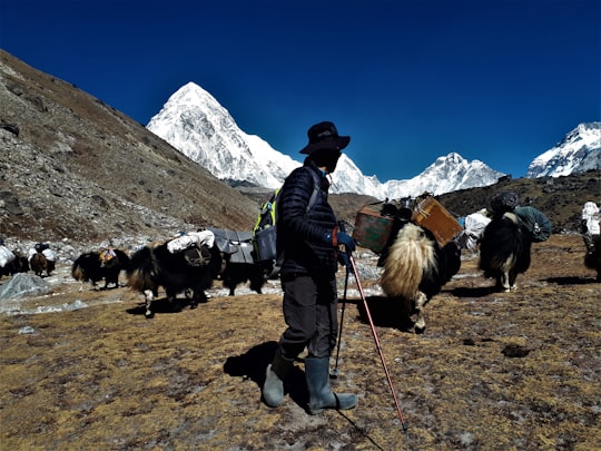

12 - Gokyo Ri
11 km away
Gokyo Peak is a 5,357 m-high peak in the Khumbu region of the Nepal Himalayas. It is located on the west side of the Ngozumpa glacier, which is the largest glacier in Nepal and reputed to be the largest in the whole Himalayas.
Learn more Book this experience

13 - Nuptse
11 km away
Nuptse or Nubtse is a mountain in the Khumbu region of the Mahalangur Himal, in the Nepalese Himalayas. It lies two kilometres WSW of Mount Everest. Nubtse is Tibetan for "west peak", as it is the western segment of the Lhotse-Nubtse massif.
View on Google Maps Book this experience
14 - Everest Base Camp
12 km away
There are two base camps on Mount Everest, on opposite sides of the mountains: South Base Camp is in Nepal at an altitude of 5,364 metres, while North Base Camp is in Tibet, China at 5,150 metres.
View on Google Maps Book this experience
15 - Gokyo Lake - Dudh Pokhari
12 km away
Gokyo is a small village in Solukhumbu District in the Himalayas of Nepal, at the foot of Gokyo Ri and located on the eastern shore of the third Gokyo Lake, Dudh Pokhari. Gokyo Cho.
Learn more
16 - Tengboche Monastery
13 km away
Tengboche Monastery, also known as Dawa Choling Gompa, in the Tengboche village in Khumjung in the Khumbu region of eastern Nepal is a Tibetan Buddhist monastery of the Sherpa community.
Learn more Book this experience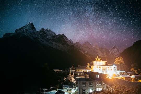
17 - Tsho Rolpa Glacial Lake
14 km away
Imja Tsho is a glacial lake created after melt water began collecting at the foot of the Imja Glacier on the lower part of the glacier in the 1950s. A 2009 study described this lake of melt water as one of the fastest-growing in the Himalaya.
View on Google Maps Book this experience
18 - Khumbu
14 km away
Khumbu is a region of northeastern Nepal on the Nepalese side of Mount Everest. It is part of the Solukhumbu District, which in turn is part of Province No. 1.
View on Google Maps Book this experience
19 - Lhotse
15 km away
Lhotse is the fourth highest mountain in the world at 8,516 metres, after Mount Everest, K2, and Kangchenjunga. Part of the Everest massif, Lhotse is connected to the latter peak via the South Col. Lhotse means “South Peak” in Tibetan.
View on Google Maps Book this experience
20 - Mahalangur Himal
15 km away
Mahālangūr Himāl is a section of the Himalayas in northeast Nepal and south-central Tibet of China extending east from the pass Nangpa La between Rolwaling Himal and Cho Oyu, to the Arun River.
View on Google Maps Book this experience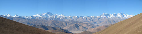
21 - South Col
15 km away
The South Col is a sharp-edged col between Mount Everest and Lhotse, the highest and fourth-highest mountains in the world, respectively. The South Col is typically swept by high winds, leaving it free of significant snow accumulation. Since 1950, most Everest expeditions have left from Nepal and gone via the southeast ridge and the South Col.
View on Google Maps Book this experience
Book Tours and Activities in Dughla
Discover the best tours and activities around Dughla, Nepal and book your travel experience today with our booking partners
Where to Stay near Dughla
Discover the best hotels around Dughla, Nepal and book your stay today with our booking partner booking.com
More Travel spots to explore around Dughla
Click on the pictures to learn more about the places and to get directions
Discover more travel spots to explore around Dughla
⛰️ Mountain range spotsTravel map of Dughla
Explore popular touristic places around Dughla