Travel Guide of Engeløya in Norway by Influencers and Travelers
Engeløya is an island in the northern part of Steigen Municipality in Nordland county, Norway. The island has an area of 69 square kilometres. The highest point on the island is the 649-metre Trohornet mountain.
Download the Travel Map of Norway on Google Maps here
Pictures and Stories of Engeløya from Influencers
Picture from Jorn Eriksen who have traveled to Engeløya

Plan your trip in Engeløya with AI 🤖 🗺
Roadtrips.ai is a AI powered trip planner that you can use to generate a customized trip itinerary for any destination in Norway in just one clickJust write your activities preferences, budget and number of days travelling and our artificial intelligence will do the rest for you
👉 Use the AI Trip Planner
The Best Things to Do and Visit around Engeløya
Disover the best Instagram Spots around Engeløya here
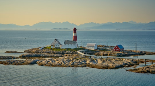
1 - Tranøy Fyr
36 km away
Tranøy or Tranøya is a village and ancient trade centre in the municipality of Hamarøy in Nordland county, Norway. It is located on the end of a peninsula about 14 kilometres north of the municipal centre, Oppeid.
Learn more
Book Tours and Activities in Engeløya
Discover the best tours and activities around Engeløya, Norway and book your travel experience today with our booking partners
Where to Stay near Engeløya
Discover the best hotels around Engeløya, Norway and book your stay today with our booking partner booking.com
More Travel spots to explore around Engeløya
Click on the pictures to learn more about the places and to get directions
Discover more travel spots to explore around Engeløya
🚢 Pier spotsTravel map of Engeløya
Explore popular touristic places around Engeløya
Download On Google Maps 🗺️📲